Geography
There is an ambitious curriculum set for Geography, supporting teachers to implement it through high-quality lessons and checking that everything is helping children to know more, remember more and do more.
If you would like more information in addition to that published on this page, please contact your class teacher.
Purpose of Study
A high-quality geography education should inspire in pupils a curiosity and fascination about the world and its people that will remain with them for the rest of their lives.
Teaching should equip pupils with knowledge about diverse places, people, resources and natural and human environments, together with a deep understanding of the Earth’s key physical and human processes. As pupils progress, their growing knowledge about the world should help them to deepen their understanding of the interaction between physical and human processes, and of the formation and use of landscapes and environments.
Geographical knowledge, understanding and skills provide the frameworks and approaches that explain how the Earth’s features at different scales are shaped, interconnected and change over time.
Aims
The National Curriculum - Geography key stages 1 to 2
- develop contextual knowledge of the location of globally significant places – both terrestrial and marine – including their defining physical and human characteristics and how these provide a geographical context for understanding the actions of processes
- understand the processes that give rise to key physical and human geographical features of the world, how these are interdependent and how they bring about spatial variation and change over time
- are competent in the geographical skills needed to:
- collect, analyse and communicate with a range of data gathered through experiences of fieldwork that deepen their understanding of geographical processes
- interpret a range of sources of geographical information, including maps, diagrams, globes, aerial photographs and Geographical Information Systems (GIS)
- communicate geographical information in a variety of ways, including through maps, numerical and quantitative skills and writing at length.
Oakfield's Approach
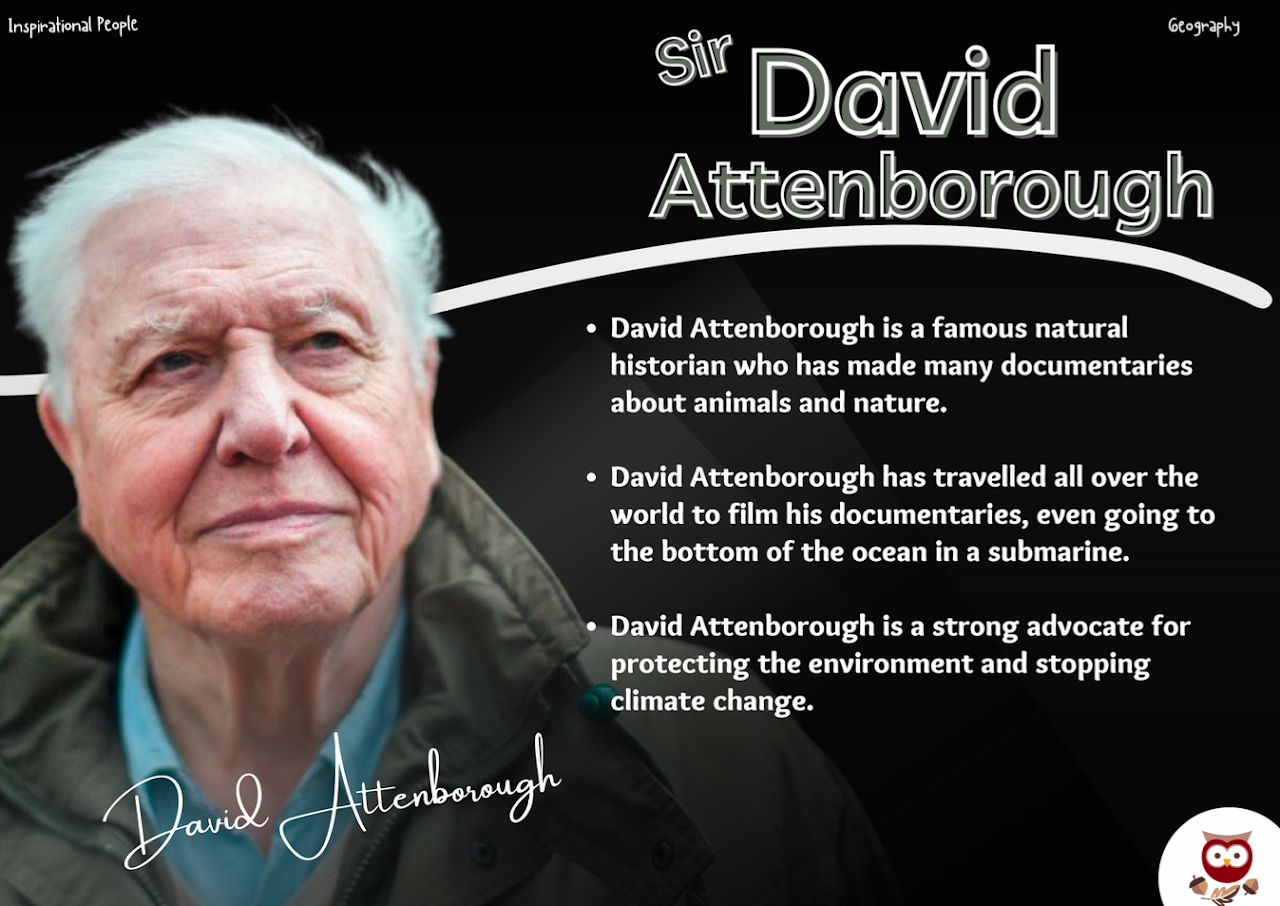
Inspirational People
At our school, we believe in using the power of inspiration to help shape the thinking and curriculum design of our students. That's why we have taken inspiration from successful and influential people who have made a significant impact in their respective fields. By studying their stories, we aim to inspire our pupils to aim high and achieve their own goals. We have carefully curated a list of inspirational figures, including scientists, artists, entrepreneurs, and activists, to name a few. We have analysed what made them successful and incorporated their values, principles, and strategies into our curriculum design to provide our students with the tools they need to succeed. By doing so, we hope to empower our students to dream big and achieve greatness.
Intent
We are setting out to help our pupils be ...
-
Secure. To find their place in the world and understand how the world works (physical processes and natural features).
-
Understanding Love the world and where they live. Protect the world and take care of the environment.
-
Resilient. Children learn that it’s okay to make mistakes in geography in order to become resilient geographers.
-
Practical. Have fun and inspiring lessons for the children to enjoy. Children learn through practical, hands-on experiences in and outside the classroom. They are inquisitive.
Implementation
We will do this by ensuring ...
-
Children are taught a broad curriculum with enrichment opportunities.
-
Children are encouraged to gather data and draw conclusions from enquiries.
-
We will provide children with time to explore and experiment with new equipment first.
-
Children use a range of geographical resources to become familiar with places and landmarks outside the UK.

Impact
We will have made a difference when ...
-
Children are curious about the world - they ask questions and set themselves enquiries. They ask to explore the local world they live in.
-
Children value and enjoy geography learning - they know how to protect the planet and their importance in doing so.
-
They will take pride in their learning, as they have refined and learned from their mistakes. Children will be able to reason and draw examples of geographical features.
-
Children can use the resources confidently - they can locate significant places on a map.
Threshold Concepts
These are our big takeaways called ‘threshold concepts’ - an overview of what we want pupils to know. They are the same for every year group and help us to ensure we build learning on the same ideas, that way we help children to be able to remember more meaningful connections rather than remembering isolated facts.
- Human features and landmarks are man-made and include transportation across the world.
- A settlement is a place where people live. Land use and water systems include agriculture and leisure.
- Four seasons affect the weather and temperature of a country. This can have extreme effects on a settlement.
- A physical process is a process that occurs naturally, such as the weather, earthquakes and the water cycle.
- Atlases, globes and aerial photographs can help develop our understanding of the location of countries, cities and landmarks.
- Using fieldwork and primary and secondary resources, we can identify, observe and collect data ready to analyse and draw conclusions.
- We can construct a geographical enquiry by asking questions and gathering evidence.
- Natural and man-made materials can be found in the natural environment but can also affect the world in different ways.
- Physical features are naturally-created features of the earth, which may change over time.
- It is important to protect our environment from pollution and damage. Our environment is made up of different zones.
- The world is made up of seven continents and five oceans. Each continent is made up of countries and cities.
- The UK is made up of four countries and is in the continent of Europe.
- The time in a country is affected by the location of the country. We can see if a country is above or below the equator.
- Using a compass and grid references can help us to position and locate features of an area on a map or Ordnance Survey.
- Maps are made up of symbols, keys, contour lines and four or six-figure grid references.
- After research and/or fieldwork, we can discuss similarities and differences between two places.
- Significant places hold importance to a country, but may pose problems for the citizens.
- A place may change over time due to tourism, physical changes or man-made changes.

Progression on a Page ...
Here is an overview of what we expect children to be taught, know and do by the end of each year group.

Year R
- In Year R, children are encouraged to explore and understand their immediate environment. They are taught to describe their surroundings using knowledge gained from observation, discussion, stories, non-fiction texts, and maps.
- Through these experiences, children develop an understanding of their local community and the world around them. They learn about the similarities and differences between life in their country and other countries, drawing on knowledge from stories, non-fiction texts, and maps.
- Children also learn about the natural world and the changes that occur throughout the year, including the seasons. They are taught to identify and describe some of the similarities and differences between the natural world around them and contrasting environments, drawing on their experiences and what they have learned in class.
- Through this learning, children develop an appreciation of the natural world and its importance. They also develop their language and communication skills, as well as their understanding of geography and science.

Year 1
- Children will be introduced to human features and will be able to describe landmarks.
- They will identify landmarks on aerial photographs and will be able to name important buildings and places.
- The children will learn what settlements are and will be able to identify patterns in the weather. They will learn how to collect simple data during fieldwork activities.
- They will identify the differences between natural and man-made materials and will start to use basic geographical vocabulary such as mountain, sea and river.
- Children will name and locate the continents and oceans on a map, as well as the four countries of the UK.
- Comparing two places will also be introduced. Children will draw or read a simple picture map and will use basic directional language.
 Year 2
- Children will now describe a local industry and understand the purposes of human features.
- They will be introduced to the process of erosion. Children will collect and organise data in charts from primary and secondary sources.
- They will describe the properties of natural and man-made materials, including where they are found.
- Using the geographical language learnt in Year 1, they will now be able to describe the size, location and position of physical features. Children will discuss ways to improve the local environment.
- They will name and locate seas surrounding the UK and will be able to locate the equator on a map.
- Simple compass directions will be introduced. Children will draw and read simple maps using symbols and keys.

Year 3
- Children will describe the type and purpose of different buildings as well as the type of settlements in an area.
- They will recognise how the weather affects urban and rural environments.
- The processes of volcanic eruptions and earthquakes are introduced.
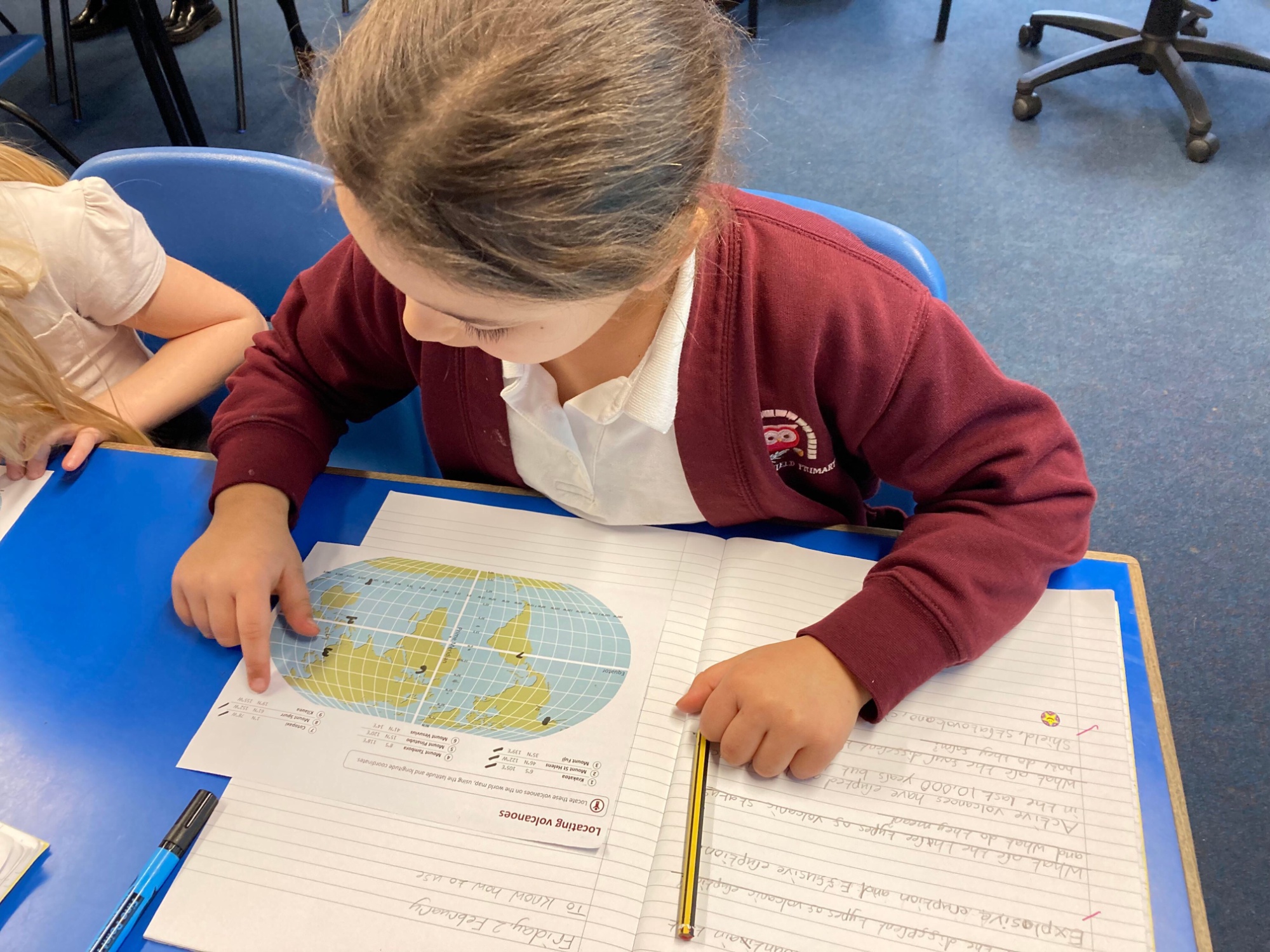
- They will name and locate significant volcanoes and plate boundaries.
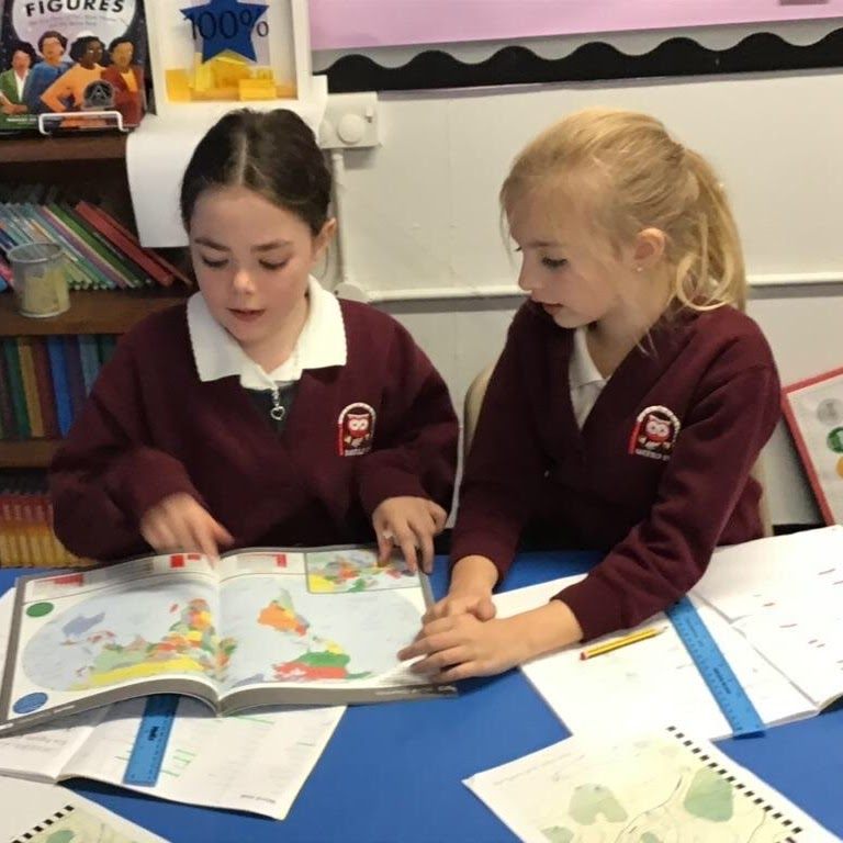
- Children will analyse maps, atlases and globes as well as primary data.
- They will be given the opportunity to gather evidence to answer an enquiry.
- The different types of rocks are introduced as well as the Earth’s four layers.
- Children will identify the five major climate zones and will locate European cities (including Russia) on a map.
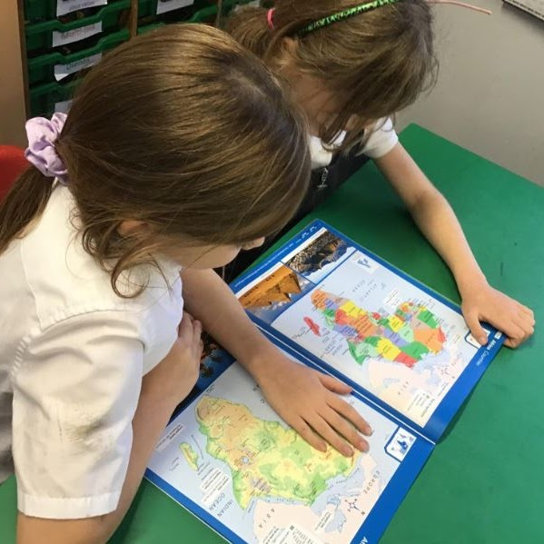
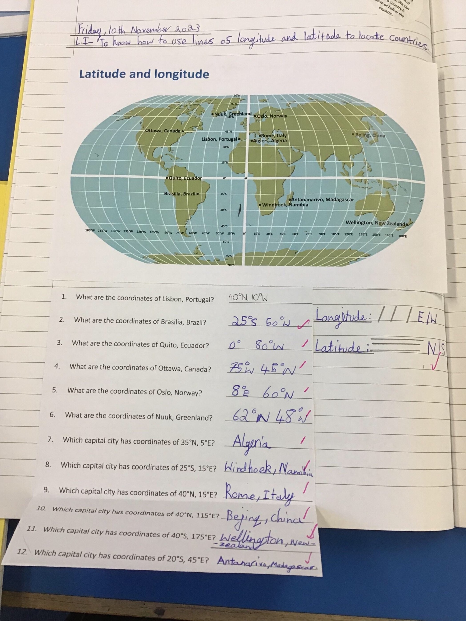
- Some counties of the UK will be introduced as well as the terms latitude and longitude.
- They will use the eight compass points and a four-figure grid reference to locate features on a map.
Year 4
- Children can explain how human features are interconnected and explain ways that settlements or water systems are used.
- The water cycle is introduced.
- They will study and draw conclusions about places and features using digital mapping.
- Children will collect and analyse primary and secondary data and will investigate a geographical hypothesis.
- They will explain the transportation of materials by rivers and the properties of soil.
- Mountain types and rivers are introduced, which includes children describing the altitudinal zonation on mountains.
- They will explain how a river changes a landscape over time.
- They will explore North, South and Central America in detail.
- Children will identify the Tropics of Cancer and Capricorn on a map and will start to use six-figure grid references.
Year 5
- Children will explain the location and purpose of transport networks across the UK.
- Agricultural land uses will be explored, including how soil fertility and drainage can affect this, including topography.
- They will explain how the climate affects land use. Conclusions from fieldwork can be made and children will be able to construct an enquiry.
- Children will name and locate the world’s biomes and vegetation belts.
- They will name and locate major world cities and will describe the relative location of cities.
- Time zones will be introduced as well as looking at aerial photographs.
- The children will use Ordnance Survey maps and will identify elevated areas, depressions and river basins on a map.
- They will explore the settlement hierarchy and report on ways to support farming in developing countries.
Year 6
- Children will describe the distribution of natural resources and industrial regions in an area and around the world.
- They will evaluate how extreme weather affects people’s lives.
- They will also describe patterns of human population of an area of the UK and how this might have changed over time.
- Satellite imaging and maps of different scales will be used and children will be able to analyse and compare data from different sources.
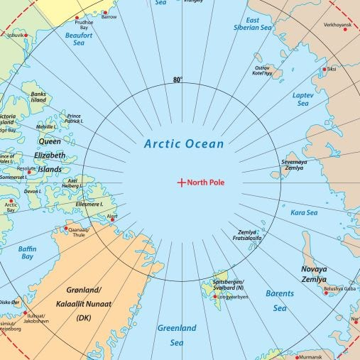
- Children will explain the importance of ice in the polar oceans and will compare the features of polar landscapes.
- They can explain how climate change affects climate zones and biomes.
- Children will describe the climatic similarities and differences between two regions.
Units of Learning ...

Year 1 - Autumn
Our Wonderful World
This teaches children about physical and human features, maps, cardinal compass points, and positional and directional language. They learn about the equator, hemispheres and continents and are introduced to the countries, capital cities and settlements of the United Kingdom. The children carry out simple fieldwork to find out about local physical and human features.

Year 1 - Spring
Bright Lights, Big City
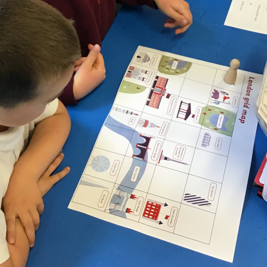
This project teaches children about the physical and human characteristics of the United Kingdom, including a detailed exploration of the characteristics and features of the capital city, London.

Year 2 - Autumn
Let's Explore The World
This essential skills and knowledge project teaches children about atlases, maps and cardinal compass points. They learn about the characteristics of the four countries of the United Kingdom and find out why there are hot, temperate and cold places around the world. They also compare England to Somalia. Children carry out fieldwork, collecting primary data in their locality to answer geographical questions.

Year 2 - Spring
Coastline
This project teaches children about the physical and human features of coastal regions across the United Kingdom, including a detailed exploration of the coastal town of Whitby, in Yorkshire.

Year 3 - Autumn
One Planet, Our World
This essential skills and knowledge project teaches children to locate countries and cities, and use grid references, compass points and latitude and longitude. They learn about the layers of the Earth and plate tectonics and discover the five major climate zones. They learn about significant places in the United Kingdom and carry out fieldwork to discover how land is used in the locality.

Year 3 - Spring
Rocks, Relics & Rumbles
This project teaches children about the features and characteristics of Earth's layers, including a detailed exploration of volcanic, tectonic and seismic activity.
Year 3 - Summer
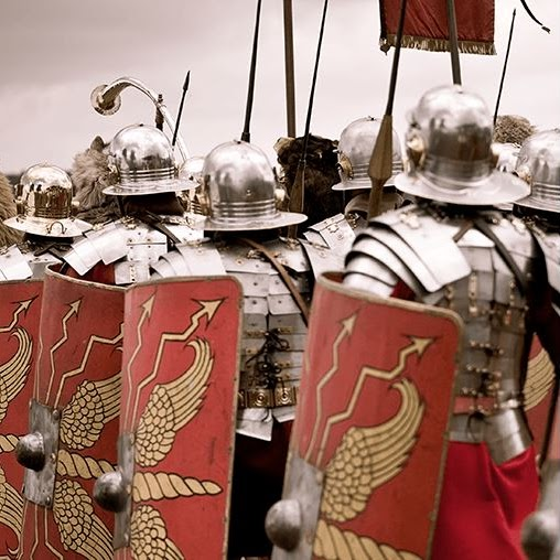
Roman Empire
In Geography, the children will learn about the countries conquered by the Roman army and how the Roman Empire grew to include many neighbouring lands.
Year 4 - Autumn
Interconnected World
This essential skills and knowledge project teaches children about compass points and four and six-figure grid references. They learn about the tropics and the countries, climates and culture of North and South America. Children identify physical features in the United Kingdom and learn about the National Rail and canal networks. They conduct an enquiry to prove a hypothesis, gathering data from maps and surveys before drawing conclusions.
Year 4 - Spring
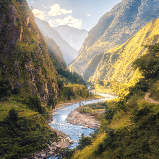
Misty Mountains, Winding River
This project teaches children about the characteristics and features of rivers and mountain ranges around the world, including a detailed exploration of the ecosystems and processes that shape them and the land around them.

Year 5 - Autumn
Investigating Our World
This essential skills and knowledge project teaches children about locating map features using a range of methods. They learn about the Prime Meridian, Greenwich Mean Time (GMT), and worldwide time zones and study interconnected climate zones, vegetation belts and biomes. Children learn about human geography and capital cities worldwide before looking at the UK motorway network and settlements. They carry out an enquiry to identify local settlement types.
Year 5 - Spring
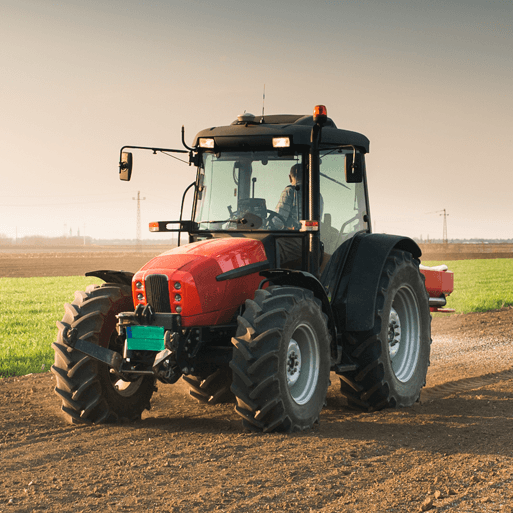
Sow, Grow & Farm
This project teaches children about the features and characteristics of land use in agricultural regions across the world, including a detailed exploration of significant environmental areas.
Year 6 - Autumn
Our Changing World
This essential skills and knowledge project revises the features of Earth, time zones and lines of latitude and longitude to pinpoint places on a map. Children find out more about map scales, grid references, contour lines and map symbols. They learn about climate change and the importance of global trade. Children analyse data and carry out fieldwork to find out about local road safety. They study patterns of human settlements and carry out an enquiry to describe local settlement patterns.

Year 6 - Spring
Frozen Kingdom
This project teaches children about the characteristics and features of polar regions, including the North and South Poles, and includes a detailed exploration of the environmental factors that shape and influence them.